Road Maps, Wish Books and Cartography
By Karen Osburn, Archivist
I like maps! There, I said it! I am one of those folks who will happily try to navigate with a few lines on paper rather than a nifty GPS with a sexy voice that tells me which road to turn down …NOW!
I am not certain when I learned to read maps. In school there were always large format maps of the world, North America, or New York State hanging on the walls of my classrooms. Whatever the curriculum was that year dictated which map you would have on the wall. I vaguely remember learning to figure out actual distance using the scale on the map. One inch might equal a mile, 10 miles, or 100 miles depending on the scale. By fifth grade I think I could figure out distance from one place to another using the accompanying scale.
I don’t think I used a map to figure out how to get from place to place until I had the freedom to ride my bike outside my neighborhood. I didn’t really put that knowledge to use until my friends and I started to drive. One of my friends who was a fan of the Cross Country Team and we would travel from school to school in her brother’s Ford convertible to watch our team run. We often went to local towns we were not familiar with and had to use a road map to find the school at which the meet was being held. Feeling intrepid and fearless in the yellow car we went to Gates-Chili, Brockport, Fairport, and many other schools all using a road map. What a feeling of confidence!
After high school graduation I often used maps to get to such exotic places as Niagara Falls, NY and Canada; Oshawa, Canada; Flint, Michigan and “Monkey Run.” My parents were horrified that I was confident enough to pack up the car and drive to another state, and while I had some close calls nothing bad happened. It was after marriage that I really got interested in where maps could take me.
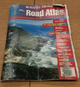
I had not traveled much before graduating from high school. It just wasn’t what my family did and so I had many places in the United States I wanted to see. Instead of a “bucket list,” I had a “do it the first chance you get list.” I was fortunate in that my husband was in favor of that agenda also and for Christmas each year he gave me a “Wish Book,” the Rand McNally Road Atlas! At last, I was free to live out my dreams. With a Chevrolet Vega station wagon and a road atlas we saw Mount Rushmore and Wall Drugs in South Dakota, Yellowstone National Park, The Grand Tetons, Estes Park, Colorado Springs, and the Rocky Mountains. We camped and saw moose and eagles, elk and bears and lots of free range cattle! All these places we got to with just a few pieces of paper and a relatively sturdy automobile.
A while ago I read up on cartography and it is a very complex skill. I didn’t assume it was simple, but even with today’s technology to get the latitude, longitude, scale, and topography correct is a challenge. Some of the words in a Wikipedia article were unknown to me and I had to look up their meaning to understand the article. For instance, a choropleth map is a map that is shaded to show certain themes, such as population density, or perhaps the education of citizens in a certain area, or per capita income.
Ptolmey drew a map of the world around 150 CE that depicted the world as being round. This work was often copied, but the original appears to have been lost with the result being that the concept of the world as a sphere, while not entirely lost became submerged by the idea of a “flat earth.” While it is sometimes difficult to decide which ancient artworks were really intended to be maps, the oldest known surviving world maps are from 9th century BCE and show the world in relation to Babylonia and the Euphrates River. Just imagining what it must have been like composing a map in 9th century BCE without satellite images, remote sensing or aerial photography is mind boggling to me. A tremendous amount of ingenuity and diligence was required to produce anything close to accurate.
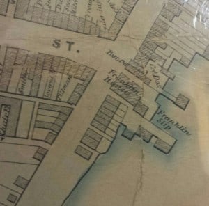
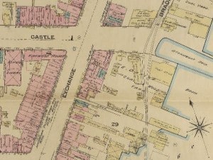
There is so much to be said about maps and map making that I could fill many pages and readers would be right to question “how does this tie into Geneva?” It ties in because there are some great maps of Geneva and they can tell us a lot about the development of the City. The Historical Society has many different types of maps in the archives with some being very detailed, some hand-drawn, some published, some helpful, some…..not very helpful. We have Sanborn Fire Insurance Maps from 1884 to 1925, maps of the Village of Geneva in 1850, 1852, 1856, and 1870, we have county atlases, town maps, and something called a “Birds Eye” view of Geneva from 1873 and 1893 that has buildings drawn with great detail. Many of these maps show footprints of building foundations, who owned the building, where shore lines were, where streams ran, where bridges were built and many other bits of information. By comparing the maps from 1850 and 1870 I can see how Geneva grew and changed. These maps are not only fascinating but useful.
I know most people will not give up their GPS in favor of a “Wish Book” but I do suggest you buy a local county map, put it in your vehicle and use it to explore the countryside. It is a lot of fun! Once I followed a dirt road drawn as a dotted line on an Ontario County map and found myself bouncing through some farmer’s potato field high up in the Finger Lakes. I was a bit surprised that it was a legitimate public road, but I certainly enjoyed the view. When I finally made my way back to the “main” road I wasn’t all that surprised to find out the road was called “Monkey Run.” I just love maps because they are the road to High Adventure!


Loved your article Karen
You are so right
Besides, MapQuest, Google Maps and the like can get it totally wrong
Though I frequently consult these mapping programs, I find them very lacking
I always want a level of detail or view that is somewhere in between the “plus” marks they offer
Two thoughts:
1) All history can be described through the lay of the land…it is a major influencer over what transpires
2) There is only one way to learn your way around this world….that is by looking out of the window
My wife loves the on board navigation systems….no matter how totally lost she gets with the grandchildren on board in some strange city or territory….she can “always” push the “home” button and the little voice will direct her to their home.
I am one of those people who can always find their way home and back to any place I’ve ever been, but must admit I am not as good as I used to be. This old brain of mine isn’t as supple as it used to be.
Thanks again…great article,
Peter
Hi Karen,
I loved your referral to ‘Monkey Run”. I know exactly where that is….not far from the cabin I used to own.
We in the geoscience community especially like maps, maps of all kinds.
But, road maps like the Road Atlas you describe are especially good. One of my colleagues,now an esteemed professor at the University of Iowa, learned to read maps upsixde down. He was corrected only when he was about age 7.
His notable accomplishment with maps was to navigate on dirt or gravel roads from Houston to Rochester in the 1960’s. I’m not sure that is possible today but it might be worth a try.